From: Dorine Duives (TU Delft) & Eelco Thiellier (gemeente Amsterdam)
Last edited: 23 June 2020
Curious about the latest developments in this living lab? Go directly to the updates.
Background
Originally the fourth living lab featured a large public event at the River IJ, named SAIL 2020. This nautical event draws over 2,3 million visitors to the embankments of the Noordzeekanaal and the IJ. Due to the widespread outbreak of COVID-19, SAIL 2020 has been cancelled abruptly.
Instead of cancelling this living lab, the CityFlows project team has decided to revamp this living lab to support the crowd management endeavors of the European municipalities pertaining to the social distancing regulations. The Crowd Monitoring Decision Support System (CM-DSS) has the potential to support crowd management organizations by means of objective real-time information, pertaining to crowd movements in hotspots during these difficult times.
Objectives of the COVID-19 living lab
The objective of this living lab is twofold. First and foremost, to develop the tools needed to be able to monitor crowd movement dynamics in potential risk areas. Secondly, to evaluate the impact of the crowd monitoring decision support systems in the management of pedestrian spaces in times of COVID-19. In particular, four actions will occur in this living lab, namely:
- Development of evaluation scheme for ‘safe’ capacity of pedestrian spaces during COVID-19
- Testing of new sensor types that can support monitoring during COVID-19
- Operational test of the new evaluation scheme in combination with the new sensor types, in collaboration with several partners in- and outside the municipality.
- Evaluation of the usability of this type of monitoring systems, for the management of pedestrian crowds, through a set of semi-structured interviews with city officials.
Locations of the Living lab
This living lab features several locations inside the municipality of Amsterdam where crowds are still expected during COVID-19 times. These are the Vondelpark, the Albert Cuyp, the Kalverstraat and the Marineterrein. The aim of the crowd monitoring systems at all four locations is to ensure public safety and limit the health risks of people who are congregating at those locations.
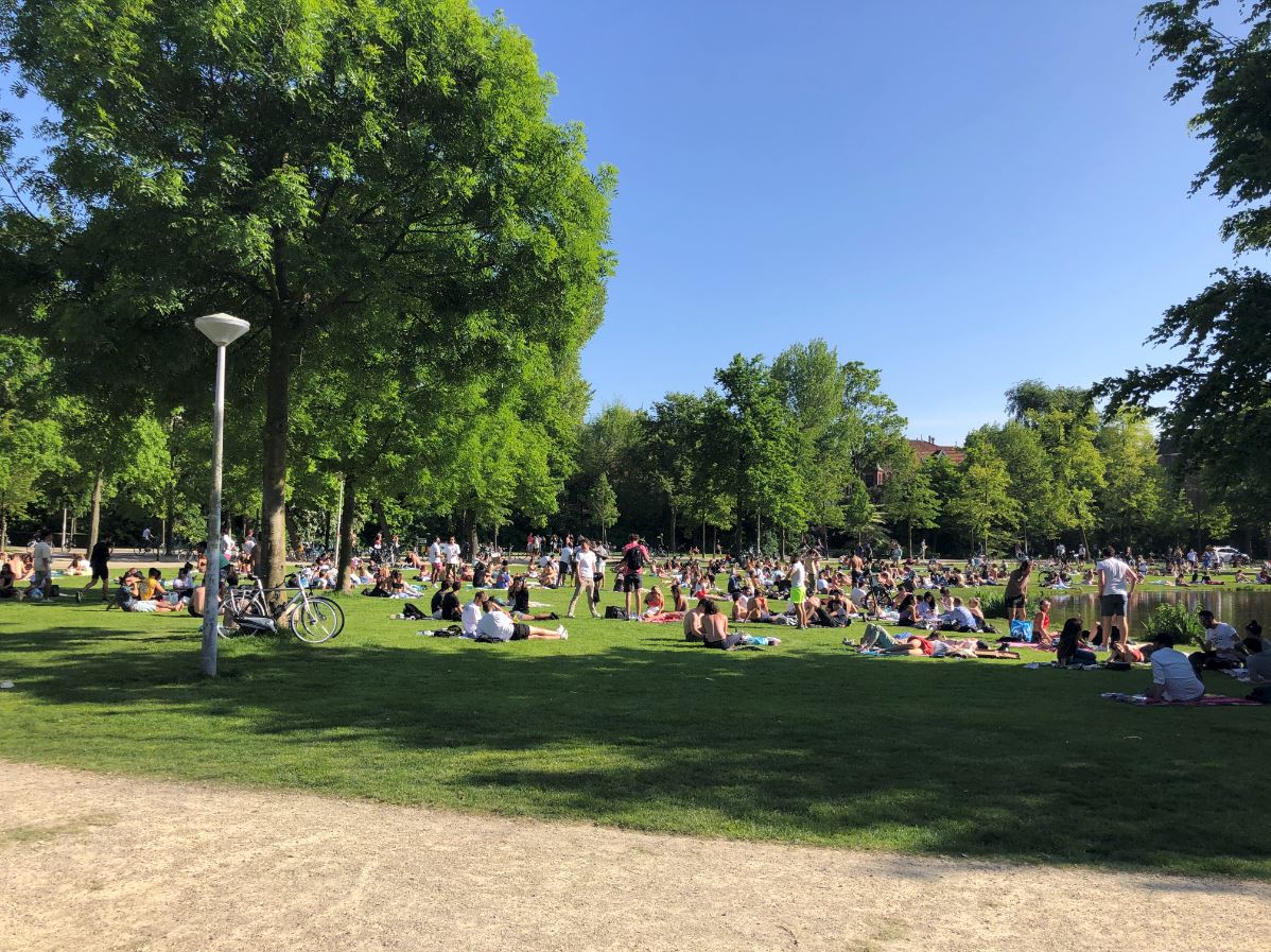 | VondelparkThis long park in the city centre of Amsterdam is located on the Stadhouderskade. Yearly, approximately 10 million visitors walk, run and cycle through the Vondelpark. The park has a surface of 47 ha and is the place to go for some sunbathing, lounging and sports activities during nice summer days. Consequently, when the temperatures rises and the sun starts shining, this park becomes crowded quickly. |
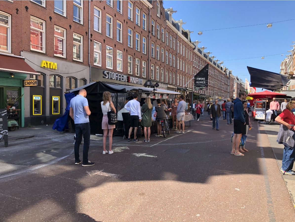 | Albert CuypstraatThis popular street in the city centre of Amsterdam is partly closed for vehicular traffic. Six days a week this street features a well-visited market, featuring produce and general purpose articles. Many tourists visit this market. Consequently, the market place is a location where ‘unsafe’ crowd densities can arise. |
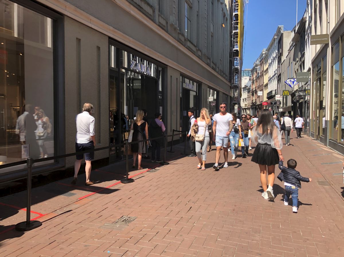 | KalverstraatThis shopping street between the Dam and Muntplein is approximately 1 kilometer long and is the home to approximately 150 shops. Even during the normal operation (before COVID-19), crowd management measures are sometimes necessary to ensure the safety of the shopping public. As the capacity of pedestrian infrastructures has plummeted due to the social distancing regulations, crowd management is important now, more than ever before. |
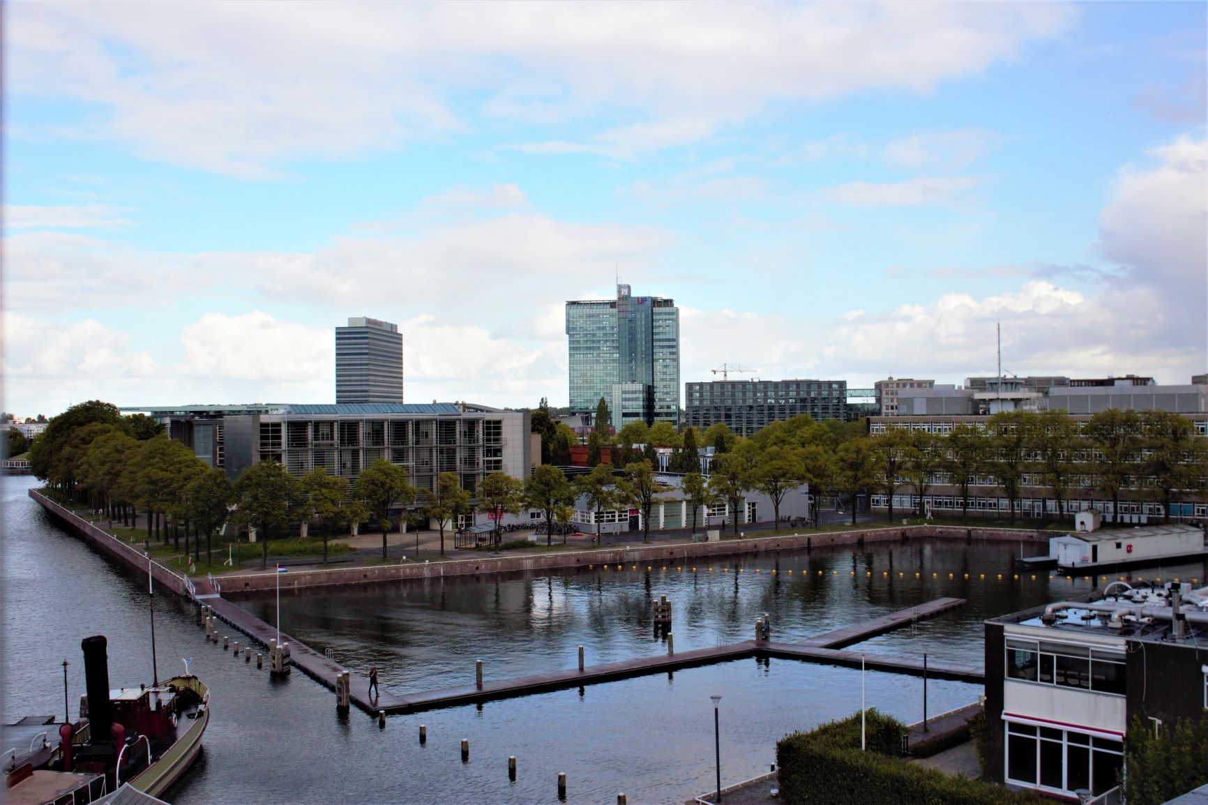 | MarineterreinThis old naval establishment is located on an island in the middle of Amsterdam. From 2013 onwards, this terrain has been appropriated to become the new hotspot for innovations in sustainable living and working. This inner-city test ground is also the host to several projects featuring smart city sensing. Where possible, CityFlows will support the development of these new technologies to monitor the movement dynamics of crowds with recreational purposes. The Marineterrein seen from the Maritime Museum. Image from SjoerdMTA (Creative Commons 4.0) |
Development of a general purpose ‘safe’ capacity scheme
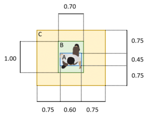
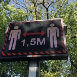
Due to COVID-19 the general capacity schemes, such as Fruin’s Level-of-Service and the Pedestrian Fundamental Diagram, are not fitting for the current movement dynamics. Thus, a new framework is required to determine when the ‘safe’ capacity of a pedestrian infrastructure is reached. ‘Safe’ because this capacity adheres to the social distancing regulations drafted by the RIVM (the Dutch National Institute for Public Health and the Environment).
Sensor testing lab
Next to the standard operation of this living lab, Amsterdam, and in particular the four locations mentioned above, will also be used as a testing ground for new sensors to measure urban movement dynamics. The aim is to test and evaluate the usage of these new sensor types. More information on the sensors can be found here. Tests with the following sensor types will be performed this year.
- 3D sensors – count, speed, density, trajectory information and heatmaps
- 2D sensors – count, speed and density
- NUMINA sensoren
- RFID sensors
- Public Eye camera’s
Updates from this Living lab
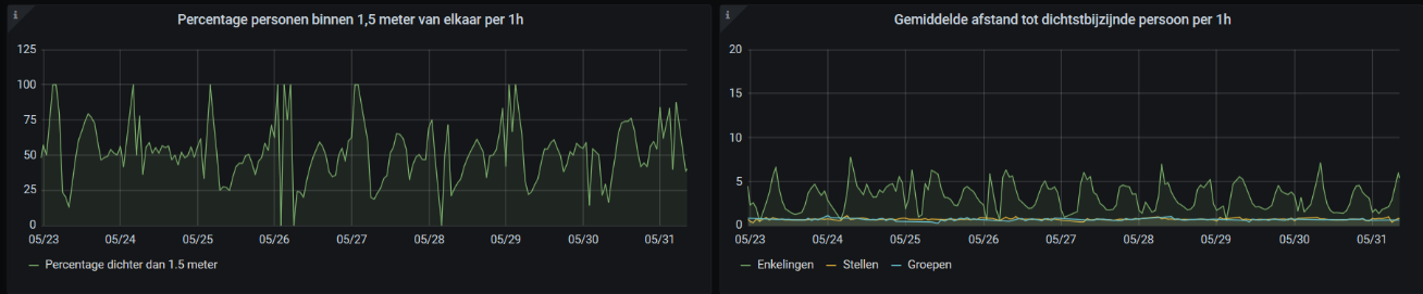
The partners of the SAIL living lab have worked hard to reset their focus. At the moment the first results are visible in practice. The municipality of Amsterdam has installed an 24/7 operational crowd monitoring system on very short notice at all three locations. Real-time data is produced and analyzed by city officials on a daily basis (see figures below).
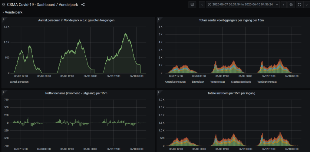
Counts at the entrances 
Counts relative to distance

Besides that, the first draft of the ‘safe’ capacity scheme is almost finalized. The TU Delft hopes to start the validation of this framework next month. When the draft is approved, it will be published open-access for everyone to use.